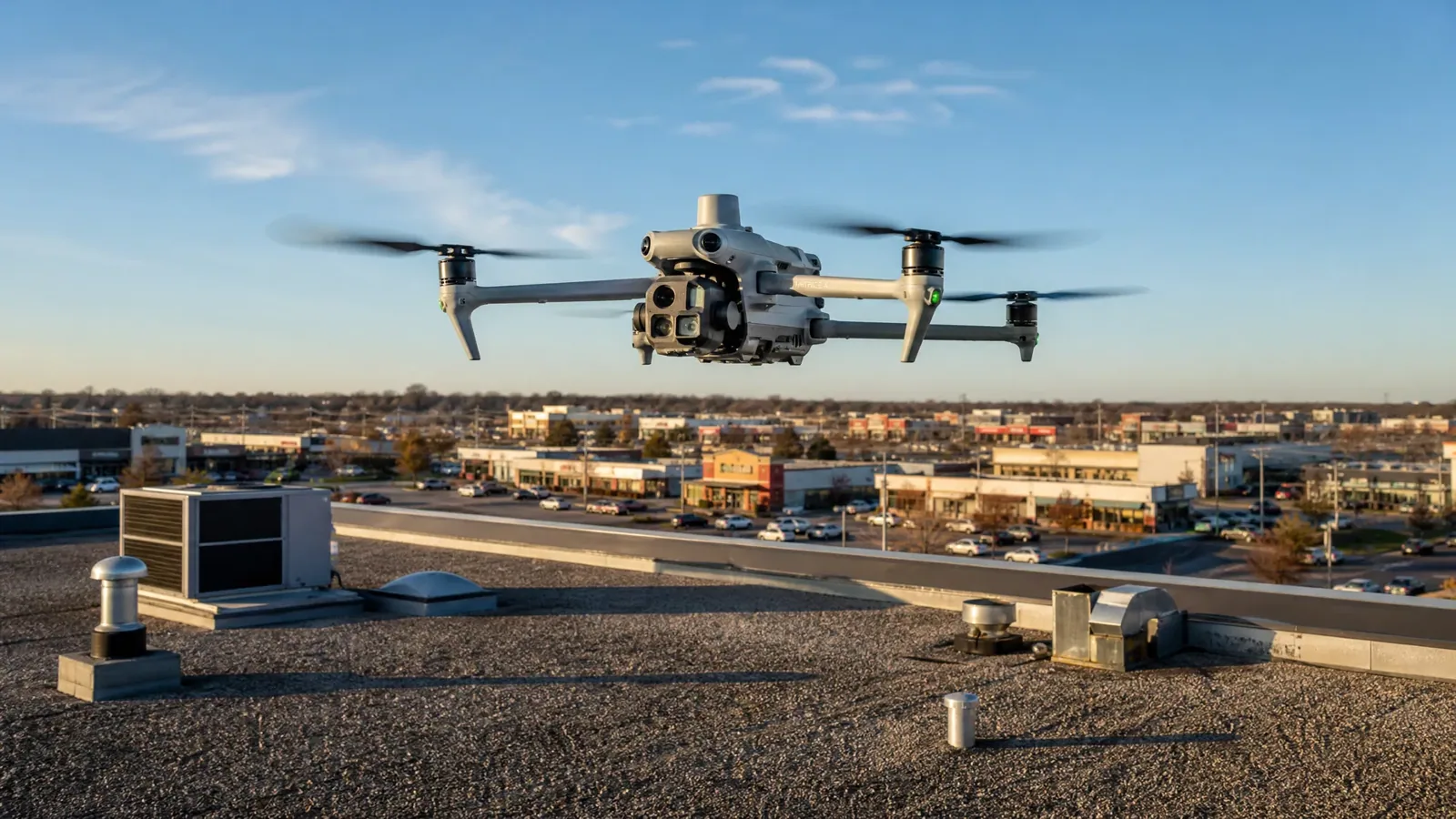
A roof too big to cross in an afternoon, a fragile skylight field, a steep edge with no safe footing, or a membrane that has gone slick with frost: there are roofs where the first look is better taken from above than from underfoot. In West Jordan, UT, where flat roofs hold snow into the spring and then shed it over a few warm days, a drone can show the whole surface of a large roof in a single pass, including the dark marks and low areas that mark where water stayed. The images give the owner a map of the roof, and the map tells the crew where to send a person with a meter.
A drone is a way to see, not a way to repair. What it finds still has to be confirmed by hand.
What the images show
High-resolution photographs taken from above reveal patterns that a walking inspector can miss. Standing-water stains show as pale rings or dark shadows where the roof does not drain. Discoloration along seams, the outline of a patch that has begun to peel, and scattered debris in a corner all show up clearly. Stains on the surface of a membrane often trace a path from a drain or a unit, which helps focus the roof walk.
Thermal imaging, when conditions are right, can add another layer. Wet insulation holds heat differently from dry, so a thermal camera flown at dusk after a sunny day can map suspect areas. Those maps are a guide, not a conclusion, and we follow them with an infrared moisture survey and core cuts where a decision depends on them.
What a drone cannot tell you
Photographs show the surface, not what is underneath it. A drone cannot press on a soft spot, probe a seam edge or read wet insulation through a membrane. Thin cracks, loose sealant and small fastener issues are often too fine to appear in a wide shot, and low sun can hide texture. A clean-looking roof in the images can still have a wet assembly below.
That is why a drone survey leads to a hands-on step instead of ending the work. Where the images raise a question, we follow with a hands-on inspection of the flagged area, and where the images show a clear defect such as a torn seam or a missing coping section, we mark it for a repair visit. The report separates what the images show from what was confirmed on the roof.
Airspace, wind and flight planning
West Jordan is served by South Valley Regional Airport, and the city reports access to I-15 and I-80. A drone flight over a roof near an airport has to respect airspace rules, so we check the flight area and, where required, obtain authorization before any flight. We also plan around wind, since a gusty afternoon on the valley floor can push a small aircraft off its line and blur the images. Snow and rain stop a flight, and bright glare off a white membrane can wash out detail, so we pick the time of day to match the surface.
Flight plans also cover people. We keep the aircraft away from parking lots, loading docks and building entries, tell the manager when the flight will take place and keep the operator and a spotter in contact. Where a roof is next to a public road, the flight path is kept clear of traffic.
Drainage and melt from above
Snow accumulation and melt are a recurring seasonal stress for the Salt Lake Valley. Weather normals from Salt Lake City International Airport describe the region, not each West Jordan roof. From above, the effect of that cycle is easy to read. Water that could not leave the roof leaves a tide line, dirt collects at the low edge of each pond, and the paths that meltwater took toward a drain are drawn in streaks across the surface.
We fly the roof after the thaw, when those marks are fresh, and follow the streaks back to their source. A line that ends at a drain bowl is normal. A line that stops at an open seam, a blocked scupper or a lifted edge shows where a ground crew should start, and it gives the owner a clear reason for a ponding repair or a drainage correction before the next winter.
Large roofs and hard access
West Jordan lists companies such as Danone, Oracle, PayPal, Amazon, Boeing and Sysco among those doing business in the city, and its general plan supports regional commercial, service, office and mixed-use buildings. The size of a company or a building does not tell us the size of its roof or what it is made of, so we start with the flight and let the images show the layout, the paths to the drains and any areas that are awkward to cross.
Drone imaging also suits roofs with fragile surfaces, such as older skylights or bubbles in a coating, where foot traffic can cause damage. For an owner in West Jordan or West Valley City, the images can help set the scope and budget before a crew walks the roof.
How owners use the images
The most common use is a before-and-after record. A set of images taken in the fall and again after the thaw shows what changed on the surface, from a new ponding mark to a lifted edge. For a portfolio, aerial images of each roof, tied to a location and date, create a shared reference that a regional manager can review without traveling to each site, and they feed a condition report with a consistent format.
The images also support planning. A map of ponding and staining helps set the scope for a repair, and an overall view of the roof helps estimate the work and sequence a replacement. After a storm, a quick flight can show where damage is concentrated before anyone climbs a ladder, which is useful for an insurance review.
Commercial Roofing Questions
Is a drone inspection enough to price a replacement?
Not alone. The images give layout and surface condition. Pricing a replacement also needs moisture readings, deck condition and attachment details that come from a roof walk and a few core cuts.
Will the flight disturb tenants?
A small drone makes some noise but little else. We tell the manager the time of the flight, keep clear of entries and parking areas, and fly during a window that suits the building.
Can you fly in winter?
On calm, dry days, yes. Snow cover hides the surface, so we prefer a flight after the melt, when stains, seams and low spots are visible and the roof is dry.
What do I receive after the flight?
A set of labeled images tied to a roof plan, a list of findings and a note on which areas need a hands-on check. The report keeps flagged images next to the follow-up action.
Does the drone replace walking the roof?
No. It shortens the walk by showing where to look first. Any area where the images raise a question still gets a moisture reading or a hands-on test.
How long does a drone flight take?
The flight itself is short even on a large roof, usually a fraction of the time a full walk would take. Reviewing the images, marking the findings and writing the report take longer than the flight.
Plan the flight
Tell us the building, the size of the roof, where water appears and how access works. We will plan the flight, share the images and say what must be confirmed on the roof before a repair boundary is set.